
Rethinking Land Governance in India
Study OAS Prism
Why Land Is India's Unfinished Constitutional Business
Land is not merely an economic asset in India — it is identity, livelihood, collateral, and, for millions of Scheduled Tribes and Other Traditional Forest Dwellers, the very ground of cultural existence. Yet decades after Independence, land governance remains fragmented, contested, and extraordinarily litigious. Understanding why requires going back to the Constitution itself.
The Constitutional Scaffolding
- Land falls under Entry 18 of State List VII of the Seventh Schedule — making it exclusively a state subject. This means the Central government can fund and incentivise, but cannot legislate directly. Every national programme for land records modernisation must work through 28 state legal regimes and over 1,000 active central and state land laws — many of which conflict with one another.
- The right to property was originally a Fundamental Right under Article 19(1)(f) and Article 31. The 44th Constitutional Amendment in 1978 removed it from Part III, relegating it to Article 300A — a mere legal right under Part XII. This means dispossession of land no longer violates fundamental rights; it only requires "authority of law", a far lower bar. The consequence has been a culture of easy land acquisition and poor record maintenance, since the constitutional imperative to protect land has been weakened.
- Articles 244(1) and 244(2) provide the Fifth and Sixth Schedule protections for tribal land in Scheduled Areas. The Panchayats (Extension to Scheduled Areas) Act, 1996 (PESA) further mandates that no land acquisition in Scheduled Areas may proceed without the consent of the Gram Sabha. The Scheduled Tribes and Other Traditional Forest Dwellers (Recognition of Forest Rights) Act, 2006 grants community and individual rights over forest land. These protective layers are constitutionally robust — but administratively weak in implementation.
The Scale of the Problem
- As of 2025, approximately 5 crore cases were pending in Indian courts, with an estimated 60% of civil litigation relating to land and property disputes. Land conflicts affected around 10.5 million people across approximately 2.5 million hectares. Investment projects worth roughly ?3.45 trillion ($200 billion equivalent) were stalled by land disputes. The average pendency from dispute creation to final Supreme Court resolution for acquisition-related cases was 20 years. Land disputes account for 25% of all Supreme Court cases, with 30% of those relating specifically to land acquisition.
- These statistics make a single point with brutal clarity: no amount of economic growth can be sustained on a foundation of contested, unverified, litigated land. The political economy of rural India — credit access, agricultural investment, housing, infrastructure — flows through the land record. A bad record is a broken promise.
The Evolution of Central Programmes
The Centre has tried to address this since 1987, when it launched the Computerisation of Land Records (CLR) scheme. In 1997, the Strengthening of Revenue Administration and Updating of Land Records (SRA&ULR) scheme supplemented it. In 2008, the UPA government merged both into the National Land Records Modernisation Programme (NLRMP) with a ?5,656 crore allocation across five years. In 2016, the NDA government revamped and renamed it as the Digital India Land Records Modernisation Programme (DILRMP) under the Digital India umbrella, funding it 100% from the Centre. Phase 2 (2021-26) carried an outlay of ?875 crore. Each phase built on the last — moving from mere data entry to map digitisation to, now in Phase 3, full GIS-based spatial integration and the dream of a National Land Stack.
DILRMP 3.0:
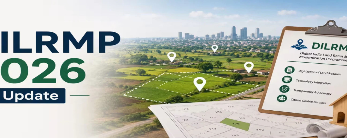
Union Minister for Rural Development Shivraj Singh Chouhan launched DILRMP 3.0 on 11 September 2026 with an outlay of ?565.50 crore for the period 2026 to 2031. The programme is funded 100% by the Centre, with releases made in phases linked to performance. This marks a qualitative shift — from digitising individual records to building an integrated, interoperable, GIS-enabled national land information ecosystem.
The Eight Core Components
|
Component |
What It Does |
Significance |
|---|---|---|
|
Computerisation of RoR & Cadastral Maps |
Completes remaining 0.1% of Records of Rights and 3% of cadastral maps |
Near-complete coverage across India |
|
Computerisation of Registration (SROs) |
Modernises remaining Sub-Registrar Offices; creates Registration Seva Kendras at 75 high-footfall offices |
Reduces waiting time, passport-seva model |
|
Bhu-Aadhaar / ULPIN |
Assigns a unique 14-digit identifier to every land parcel; enables full georeferencing of cadastral maps |
Eliminates duplicate/fraudulent records |
|
National Land Stack (GIS) |
States build individual Land Stacks that integrate via APIs into a federated National Land Stack |
Interoperability while preserving local control |
|
NAKSHA |
GIS-based urban land mapping; generates Urban Property Cards for all urban land parcels |
Bridges rural-urban gap in records |
|
Revenue Court Case Management (RCCMS) |
Computerises revenue courts for faster case resolution |
Reduces pendency in land tribunals |
|
Legacy Record Scanning |
Digitises historical property documents into secure repositories |
Protects inheritance rights, oral lineage |
|
Capacity Building & MIS Dashboard |
DILRMP Cell at every state; real-time DILRMP-MIS monitoring |
Performance-linked fund release |
The Bhu-Aadhaar: India's Most Important 14-Digit Number
The Unique Land Parcel Identification Number (ULPIN), popularly called Bhu-Aadhaar, is the architectural centrepiece of DILRMP 3.0. Every land parcel in India — whether agricultural, forest, urban, or tribal — is assigned a unique 14-digit number derived from its GIS coordinates. This makes every parcel traceable, its boundaries verifiable by satellite, and its ownership chain auditable. Once assigned, the Bhu-Aadhaar enables:
- Credit linkage: Farmers can pledge land electronically without visiting government offices, enabling faster institutional credit.
- Scheme targeting: PM-KISAN, PM Awaas Yojana, and MGNREGS can be seeded to verified land parcels, eliminating duplicate or ghost beneficiaries.
- Dispute prevention: GIS-based boundaries leave no scope for boundary disputes or double-registration fraud.
- Tribal safeguards: If implemented equitably, community and forest land parcels can be formally mapped, protecting them from illegal alienation.
The Land Stack Architecture: Federalism in Practice
Each state is required to build its own Land Stack — a layered digital integration of land records, cadastral maps, registration data, agricultural maps, forest maps, and urban property data through APIs. Individual state stacks plug into a National Land Stack through standardised data protocols. This federated model respects the constitutional position of land as a state subject while enabling national-level analytics, scheme delivery, and dispute tracking. The model is analogous to the Goods and Services Tax Network (GSTN), where state-level compliance feeds a national data architecture.
What Two Decades of Digitisation Achieved
Before assessing DILRMP 3.0, it is essential to honestly evaluate what the previous phases accomplished — and where they fell short.
|
Indicator |
NLRMP 2008 (Baseline) |
DILRMP Phase 1&2 (2026 Achieved) |
|---|---|---|
|
Records of Rights digitised |
~60% |
99.9% (near-complete) |
|
Cadastral maps digitised |
~40% |
97% |
|
Sub-Registrar Offices computerised |
~30% |
99% |
|
GIS georeferencing of villages |
Negligible |
~49% (3,26,776 of 6,57,397 villages) |
|
Bhu-Aadhaar / ULPIN assigned |
Not launched |
In rollout (incomplete) |
|
State revenue courts computerised |
Nil |
Partial — high variance across states |
The headline achievements are impressive. The persistent gaps reveal the limits of the approach. Georeferencing — the process of mapping every village's cadastral map onto real GPS coordinates — was barely halfway complete as of December 2023. Without georeferencing, the Bhu-Aadhaar cannot be assigned, and the Land Stack cannot be built. Phase 3 must therefore finish the foundational work that phases 1 and 2 left incomplete.
Presumptive Versus Conclusive Titling
The deepest structural problem in India's land governance — one that DILRMP 3.0 does not resolve — is the nature of the title itself.
What India Has: Presumptive Titling
In India, a Record of Rights (RoR) — the jamabandi or khatiyan — is merely a presumptive document. It is presumed correct unless challenged in court. It does not guarantee ownership. Courts routinely overturn registered records when faced with contradicting possession evidence, older title deeds, or customary claims. Digitising a presumptive record simply makes the presumption more accessible and efficient — it does not make it legally conclusive.
What India Needs: Conclusive Titling
Countries like Australia (under the Torrens title system, introduced 1858), Canada, and Singapore operate on conclusive titling. Once a parcel is registered under a conclusive title system, the state guarantees ownership. Disputes cannot unravel the registered title — aggrieved parties are compensated monetarily by a state-backed assurance fund. The result is dramatically lower litigation, faster credit markets, and investor confidence. Australias land dispute rate is a fraction of Indias.
NITI Aayog's 2020 Model Bill on Conclusive Land Titling proposed a framework for India to transition to a state-guaranteed title system. It envisioned: a one-time survey-based settlement of every parcel; a statutory period during which disputes could be raised; and thereafter, a government-backed conclusive title immune from future legal challenge. No state has adopted the model bill in full. DILRMP 3.0 does not mandate conclusive titling — making the ?565 crore investment an upgrade of a flawed system rather than a transformation of it.
The Fragmented Administration Problem
Land records in India are managed by three separate departments that rarely communicate: the Revenue department (maintains RoRs), the Survey and Settlement department (maintains cadastral maps), and the Registration department (records property transactions). Changes in one set of records routinely fail to trigger updates in the others. A property sold and registered today may still show in the previous owner's RoR for years. DILRMP's Land Stack aims to solve this through API-based integration, but the solution requires legal reform — not just technology — to ensure that a registered sale automatically and mandatorily updates the RoR without any human intervention.
Odisha Perspective:
Odisha's Performance Under DILRMP Phases 1 and 2
Odisha's Revenue and Disaster Management Minister Suresh Pujari, representing the state at the DILRMP 3.0 launch on 11 September 2026, declared that Odisha achieved a success rate of approximately 99.8% in the first two phases of computerisation. This places Odisha among the best-performing large states in the country. The specific achievements are:
- 1,99,86,487 land records computerised (Revenue Records / Records of Rights)
- 51,742 of 51,802 villages have cadastral maps digitised — a coverage rate of 99.88%
- 213 of 321 Sub-Registrar Offices fully computerised; 108 offices established in 2025 are awaiting technological upgrades under DILRMP 3.0
- 311 of 317 tehsils now have modern Record Rooms
- DILRMP Cell established at the Revenue Officers' Training Institute (ROTI), Gothapatna, Bhubaneswar for capacity building
Hi-Tech Surveys in Six Districts
The most consequential on-ground work underway in Odisha is the hi-tech cadastral resurvey, currently in progress across six districts: Jharsuguda, Jagatsinghpur, Jajpur, Kendrapada, Kalahandi, and Ganjam. These surveys use drone-based photogrammetry and DGPS (Differential Global Positioning System) to generate precise boundary coordinates for every parcel. Once completed, these parcels will receive Bhu-Aadhaar numbers and become part of Odisha's state Land Stack. The choice of districts — spanning coastal plains (Jagatsinghpur, Kendrapada), industrial belts (Jharsuguda, Jajpur), and tribal-agrarian zones (Kalahandi, Ganjam) — reflects an intent to cover diverse land typologies.
Bhulekh: Odisha's Digital Land Records Portal
Odisha's Bhulekh portal (bhulekh.ori.nic.in), managed by the Revenue and Disaster Management Department, allows any citizen to access their Record of Rights, plot information (thana, patta, khata), Mutation Register, and Court Case status online. It is one of the most visited government portals in Odisha, routinely handling lakhs of queries per month. DILRMP 3.0 will enhance Bhulekh by integrating GIS maps, enabling spatial queries, and linking sub-registration data automatically.
The Jaga Mission: Odisha's Global Model for Urban Land Rights
While DILRMP focuses on rural and cadastral records, Odisha's Jaga Mission addresses a parallel crisis: the estimated 25% of Odisha's urban population living in informal slums without land titles. The Odisha Land Rights to Slum Dwellers Act, 2017 — the first legislation of its kind in India — created the legal framework to issue land rights to slum dwellers. Formally launched as the Odisha Liveable Habitat Mission in 2018, the programme:
- Targets approximately 1.7 million people across nearly 3,000 slums in 115 cities
- Has upgraded 1,680 slums and declared 28 cities slum-free (as of mid-2024)
- Established 2,919 Slum Dwellers Associations, with 52% women members on executive committees
- Issues Patta (land titles) to slum dwellers, enabling access to credit, scheme benefits, and secure tenure
The Jaga Mission has received international recognition from the World Bank and UN-Habitat as a model for pro-poor urban land rights. Its integration with DILRMP 3.0's NAKSHA component — which prepares GIS-based Urban Property Cards — creates a powerful synergy: urban informal settlements can now be formally mapped, titled, and integrated into the city's property tax and planning database.
The Odisha Land Encroachment Bill 2026 and DILRMP's Double-Edged Sword
The Odisha Land Encroachment Bill 2026, recently passed by the Odisha Legislative Assembly, aligns directly with DILRMP 3.0's emphasis on digital records as primary evidence. The Bill:
- Empowers Revenue Officers to issue immediate conditional eviction orders upon encroachment reports
- Treats satellite imagery and digital land records as primary evidence, replacing physical documentation
- Includes a regularisation pathway through the Jaga Mission framework for eligible slum dwellers
- Creates dedicated land tribunals to reduce civil court burden
However, civil society organisations and constitutional law experts have flagged a critical concern: tribal and forest-dwelling communities — who hold traditional occupation rights that predate any digital record — may have no digital footprint of their occupation. If digital records become the primary legal evidence for title, communities whose rights exist in the physical world but not in a government database face a systemic risk of dispossession. Odisha has approximately 22.85% Scheduled Tribe population, concentrated in districts like Mayurbhanj, Kandhamal, Koraput, Malkangiri, and Nabarangpur — many of which overlap with Fifth Schedule areas protected under Article 244 of the Constitution. In these areas, PESA (1996) mandates Gram Sabha consent before any change in land use. The DILRMP 3.0 framework and the Encroachment Bill must explicitly safeguard these protections, or risk digitising away the constitutional rights of Odisha's most vulnerable communities.
The Missing Chapter in Digitisation
If DILRMP 3.0 has a blind spot, it is the approximately 67 million Scheduled Tribe people in India for whom land is not just economic — it is spiritual, communal, and constitutionally protected.
The Protective Legal Architecture
|
Provision |
Protection Offered |
Implementation Status |
|---|---|---|
|
Article 244(1), Fifth Schedule |
Governor's discretion to regulate land transfer in Scheduled Areas; creation of Tribal Advisory Councils |
Partially implemented; varies by state |
|
PESA, 1996 |
Gram Sabha consent mandatory for acquisition; Gram Sabha as primary land governance unit in Scheduled Areas |
Under implemented nationally; Odisha notified rules in 2024 |
|
Forest Rights Act, 2006 |
Individual and community rights over forest land for traditional forest dwellers |
Large backlog of pending claims nationally |
|
Land Transfer Regulation Acts (state-specific) |
Prohibits non-tribal purchase of tribal land in many states |
Routine violation through benami transactions |
A 2026 report by Land Conflict Watch documented 179 active land conflicts in India, affecting 7.3 lakh hectares and 3.6 million people. The majority of these conflicts involved tribal or forest-dwelling communities whose customary rights lacked formal documentation. When DILRMP data does not capture a community's occupation, the community becomes invisible — legally erasable.
The critical reform needed is a mandatory provision within DILRMP 3.0 that requires states to map and record community land parcels, forest rights claims, and customary occupation before any Bhu-Aadhaar assignment is treated as final. The system must start with the principle that absence from the record is not absence of right — particularly in Fifth Schedule areas.
Way Forward:
- From Presumptive to Conclusive Titling
- The most transformative reform India can undertake in land governance is the adoption of the NITI Aayog 2020 Model Bill on Conclusive Land Titling. States should enact legislation providing for a time-bound survey-based settlement of title, a statutory dispute-filing window, and thereafter a state-backed conclusive title with a government-funded compensation mechanism for good-faith claimants. This aligns with the proven Australian Torrens system and would eliminate the structural source of India's land litigation backlog.
- Integrated Land Authority
- The CPR and Law Commission have recommended creating a single Integrated Land Authority within each state — or a Ministry of Land at the Centre as a nodal body — to merge the currently siloed Revenue, Survey, and Registration departments. Without this structural integration, the Land Stack will remain a technical architecture layered over an administrative silo.
- Legal Rationalisation
- India has over 1,000 active central and state land laws. Parliament should mandate a Land Laws Rationalisation Commission — analogous to the Law Commission — specifically to identify, rank, and recommend repeal or consolidation of conflicting land statutes. Until the legal architecture is simplified, no digital platform will eliminate the scope for litigation.
- Protecting Tribal Rights in the Digital Transition
- Every state with Fifth Schedule areas must undertake a mandatory Community Rights Mapping exercise — funded under DILRMP 3.0 — before assigning Bhu-Aadhaar to any parcel in a Scheduled Area. This mapping must involve Gram Sabhas as primary stakeholders under PESA. The Forest Rights Act claims process must be integrated with the Land Stack so that pending and recognised forest rights appear as legal encumbrances on any disputed parcel.
- Judicial Reforms
- Dedicated Land Tribunals — specialised courts with trained revenue judges and mandatory time-limits for disposal — must be established in every district, particularly in states with high land dispute rates. The Law Commission's recommendation of 50 additional judges per million population remains unimplemented; beginning with revenue courts would produce the highest impact per appointment.
- International Best Practice
- Singapore's land registry offers a useful model for urban land: every transaction is registered within 24 hours; the register is conclusive; and all three parties — buyer, seller, bank — transact in a paperless digital ecosystem. Odisha's Bhulekh and the Jaga Mission's digital title system could be scaled toward a comparable model, making Bhubaneswar and other cities centres of dispute-free urban property markets.